The Distillery theorem
Posted on May 10th, 2011 – 3 CommentsArt + Alcohol = The Distillery District
I mean, how else do you explain things like this?
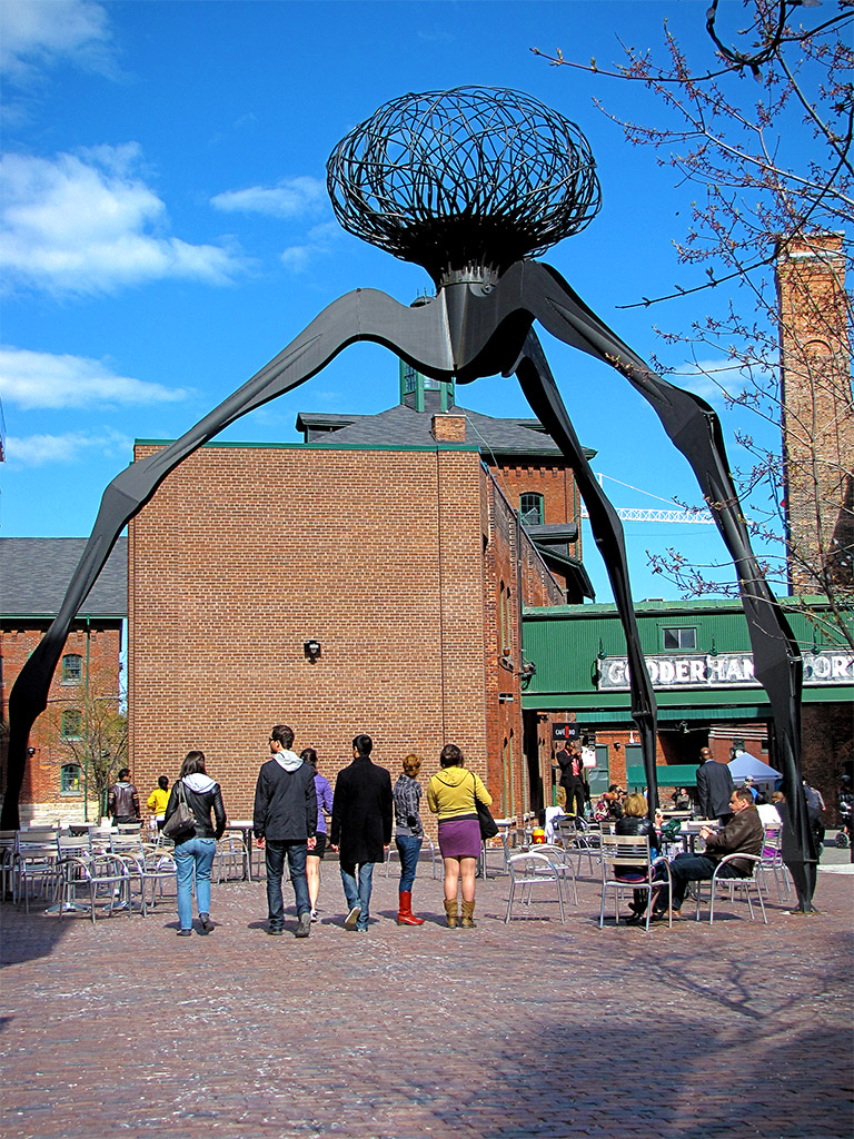


Art + Alcohol = The Distillery District
I mean, how else do you explain things like this?
According to the Toronto Star’s Christopher Hume, everybody’s always asking him what the best and worst buildings in the city are. Plus, everybody loves a list. Who am I to argue with such hyperbole-free reasoning? Besides, I have my own faves, and although Chris’ picks would probably make my own Top-20 list, I’m not convinced everybody, everywhere, throughout all known time and dimensions, would agree with either of us. Still, Chris’ picks are a good place to start.
Here’s his #5 pick, the Pure Spirit building that marks the north-west corner of the Distillery District and which, as Mr. Hume so aptly points out, brought order and reason to an area of town that barely obeyed the laws of physics.
Every now and again, when people learn about what I do (did), they ask me earnestly why I’d choose to stay in Toronto.

Easy to answer: it’s an awesome city. As soon as the right people are at the helm at City Hall, it’ll be truly world-class. In some ways the city is already busting at the seams in this regard, it’s simply the government that keeps reining it in.
Election day is coming and, regardless of this, the city is blooming with construction, flowers, and lovely ladies. And as I’m sure I’ve mentioned, I’ve seen a good selection of cities; enough to know that I haven’t seen nearly enough. Toronto isn’t the cheapest, or the cleanest, or the busiest, or the biggest, but it’s also not the dirtiest, most boring, barren, or small by any means. Any tourists that complain about deficiencies in these areas are, well, tourists. The city’s way bigger than that (have you see how little I’ve covered in TCLand?), and growing by leaps and bounds. Frickin’ jackhammer outside my window right now, in fact.
With so much growth it’s extremely important to keep a steady vision otherwise it could get real messy. Here’s a great example: the new designs recently unveiled for the new north hall of St. Lawrence Market. The market has been around since basically Toronto’s been here but the north hall, which to me resembles a stripped-down school gymnasium, is much newer. On Saturdays local growers truck in their produce and on Sundays it’s an antique market.
I know I’ve probably mentioned this before but I know that many people don’t get a chance to visit that area, so to help you out I’ve taken photos from approximately the same locations as in the literature. That way you can see the before and proposed-after shots.
The design teams for the north hall project are split up into five colours but obviously the orange team is the best. A rooftop garden? Hells yeah!
Anyhow, here they are, winner to be decided by committee. :(
That romp I took through the Toronto Archives the other day didn’t end there, dear reader. It went on for hours as I pored maps and stories of the city dating back to 1834, when Toronto first became Toronto. Okay, possibly the second time, but this time the King himself signed off on it. York it weren’t no more anyhow.
It all started with innocently enough. I usually just close the window after flipping through the photos but this time, just for fun, I decided to click on the Archives logo in the corner. Sometimes their web exhibits are suuuuuuper boring. But this time, for Toronto’s 175th, they did a series on the city in 1834.
And now I can say that I know where the original city extended to — it’s been something of a bug on my itchy brain for a while now.
I checked the maps against current street names and locations and the boundary points I came up with seem to agree with the maps going back to 1834. Unfortunately these points disagree with the Archives’ analysis, but I don’t care.
According to me, the north-eastern edge of 1834 Toronto is the intersection of Queen Street and River Street:
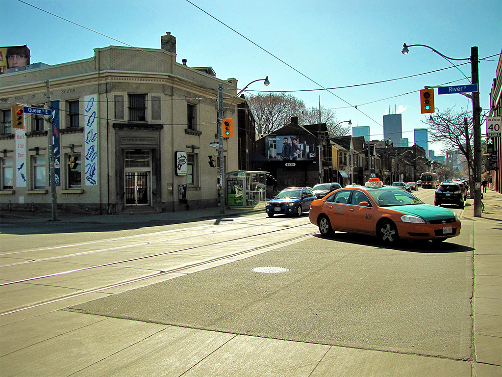
At that time Queen Street was called Lot Street because it led to a bunch of allotted land — lots. Also, there was no queen. Clever.
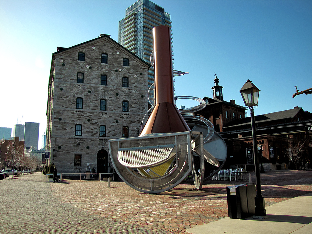
The photos, by the way, are looking into the old city from the four corners. Some of those corners haven’t seen much action since the old city, as you can see above. Others, like the south-eastern Gooderham’s mill and later Worted boozery, have been since been gussied up:
But if full-on historical effacement is your thing (it’s okay to admit you like modern), the south-western edge on Front Street doesn’t get any more devastating. Not only is the intersecting Peter Street discarded for Blue Jays Way (organized ball leagues weren’t really a priority in 1834), but there is literally nothing left of the original city except Front Street:

