


The edges of tedium
Posted on March 29th, 2010 –
That romp I took through the Toronto Archives the other day didn’t end there, dear reader. It went on for hours as I pored maps and stories of the city dating back to 1834, when Toronto first became Toronto. Okay, possibly the second time, but this time the King himself signed off on it. York it weren’t no more anyhow.
It all started with innocently enough. I usually just close the window after flipping through the photos but this time, just for fun, I decided to click on the Archives logo in the corner. Sometimes their web exhibits are suuuuuuper boring. But this time, for Toronto’s 175th, they did a series on the city in 1834.
And now I can say that I know where the original city extended to — it’s been something of a bug on my itchy brain for a while now.
I checked the maps against current street names and locations and the boundary points I came up with seem to agree with the maps going back to 1834. Unfortunately these points disagree with the Archives’ analysis, but I don’t care.
According to me, the north-eastern edge of 1834 Toronto is the intersection of Queen Street and River Street:
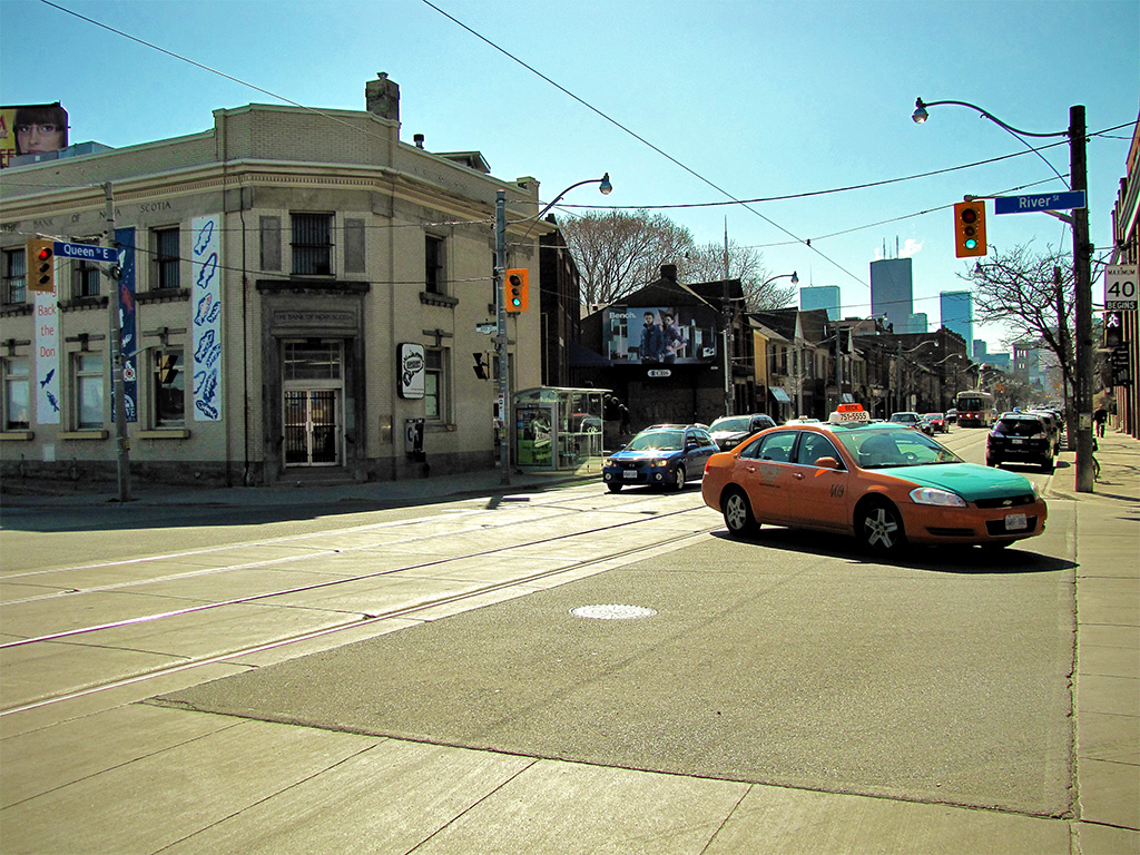
At that time Queen Street was called Lot Street because it led to a bunch of allotted land — lots. Also, there was no queen. Clever.
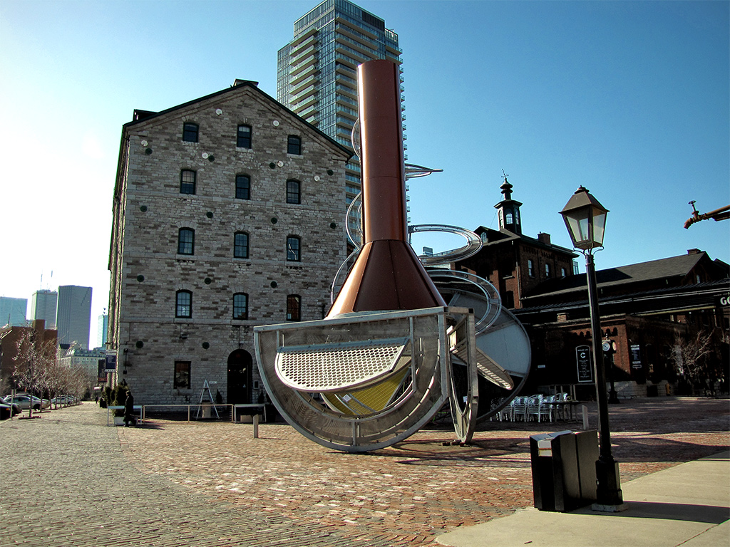
The photos, by the way, are looking into the old city from the four corners. Some of those corners haven’t seen much action since the old city, as you can see above. Others, like the south-eastern Gooderham’s mill and later Worted boozery, have been since been gussied up:
But if full-on historical effacement is your thing (it’s okay to admit you like modern), the south-western edge on Front Street doesn’t get any more devastating. Not only is the intersecting Peter Street discarded for Blue Jays Way (organized ball leagues weren’t really a priority in 1834), but there is literally nothing left of the original city except Front Street:

Lot (Queen) Street would’ve been Toronto’s northern edge at that time. Yonge street ascended north to farmlands and occasional grand estate homes, but that was it. Nothing else but bush, natives, and Canadian Geese. So it’s probably safe to assume that many of the buildings along north-western Queen probably came later:

All said and done, you would’ve been able to walk from one edge of town to the other in about forty minutes. Make that fifty what with all the horse crap all over the place. On the southern edge, the Islands were a peninsula and everything south of the Gardiner was under water.
View Larger Map
Ahhh!
That bug’s been thoroughly scratched. Now I know where the original city stood and I even learned a little history.
Then I started reading about the massive fire of 1904 and the wave of immigrants that descended on Toronto during the Irish Famine, including a terrific editorial quote from the Globe at the time:
Irish beggars are to be met everywhere, and they are as ignorant and vicious as they are poor. They are lazy, improvident, and unthankful; they fill our poorhouses and our prisons, and are as brutish in their superstition as Hindoos.
Wicked. You just can’t make stuff like that up. :D
I guess Toronto history isn’t as tedious as I thought. Great. Now those bugs in my brain have multiplied!


March 29th, 2010 6:14 pm
I love reading and seeing history like this. Thanks for adding photos with your post. I lived in Toronto a long time but I'm in Barrie now. I'd like to make a post like this for Barrie. Will take me awhile to find out about the old town.
March 30th, 2010 12:03 pm
Barrie could certainly use online representation, Laura. It may not be my own #1 city (I believe I'm quite clear on this), but I've been there and seen its charms. I'd love to visit in a snowstorm :) Plus, Highway 400 and it's traffic is clear evidence of how fast Barrie is growing. Witnessing growth like that is what motivated TCL — change is a great time to record.